

Why the Colorado Plateau made Utah an outdoor destination

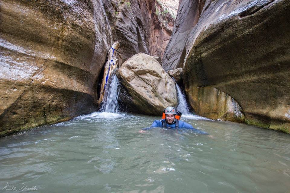
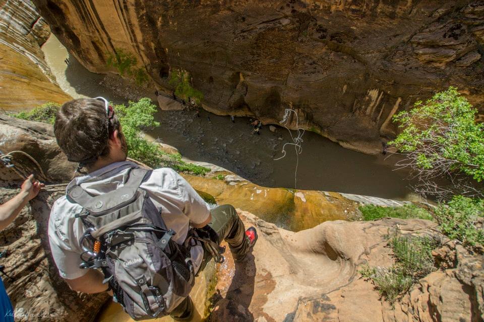
Canyoneering in Zion National Park, Keyhole Canyon
Southern Utah was created by many geological forces, leading to one of the premier outdoor recreation areas in the world. Utah has long boasted the “Greatest Snow on Earth”, but the southern half of the state, the Colorado Plateau, is a large area of sandstone and other layers presenting a plethora of outdoor recreation opportunities. Southern Utah, with its 5 national parks and diverse landscapes, is a central hub for most desert style outdoor recreationists.
Outdoor recreation is beneficial to all people. There are economical mental, social and physical benefits to being outdoors. The Colorado Plateau offers the ability to experience all the benefits from a wide variety of activities.
Mentally, outdoor recreation allows a person to escape from the busy world we live in today (Atchley 2012). Setting aside this busy, technological world allows for the mind to regenerate memory, thought and creativity functions. Socially the outdoors are able to bring people together from all forms of backgrounds. As Plato said, “You can learn more about a person in an hour of play than in a year of conversation.” Physically it should be obvious; you are getting outside and exercising to see the outdoor world.
Outdoor recreation is a large business, especially in Utah, the Outdoor Industry Association says that outdoor recreation accounts for $646 billion in national sales and supported 6.1 million jobs in 2011. This is all outdoor recreation pursuits; winter sports, backpacking and hiking, off-road vehicles and more. One of the fastest growing adventure sports is canyoneering, a sport that requires the unique landscapes offered on the Colorado Plateau (Black 2008).
What is Canyoneering?
Canyoneering is an adventure sport requiring technical skills of hiking, route finding, swimming, rappelling and climbing. Canyoneering is at least several hundred years old (Black 2008), but done in the past more by necessity than recreation. Native Americans used the rugged canyons of the southwest for living, food storage and safety. Cowboys and pioneers explored all these canyons looking for Native American artifacts and treasure. It wasn’t until the twentieth century that exploring these canyons caught on with aging climbers, cavers and mountaineers that it became a form of recreation. It was made popular in 2003 when Aron Ralston who, after 5 days stuck in a slot canyon, amputated his own arm to survive (Ralston 2004). Ralston was one of the few at the time who enjoyed, or was capable of entering slot canyons that required technical abilities to safely descend; granted, Ralston’s wasn’t the traditional definition of safely.
One of the things drawing people to canyoneering is that each canyon is vastly different; the earth doesn’t create exactly the same in all areas. Canyoneers have created a rating system to help define canyons to alleviate risks of beginners from entering advanced canyons and people losing more than an arm.
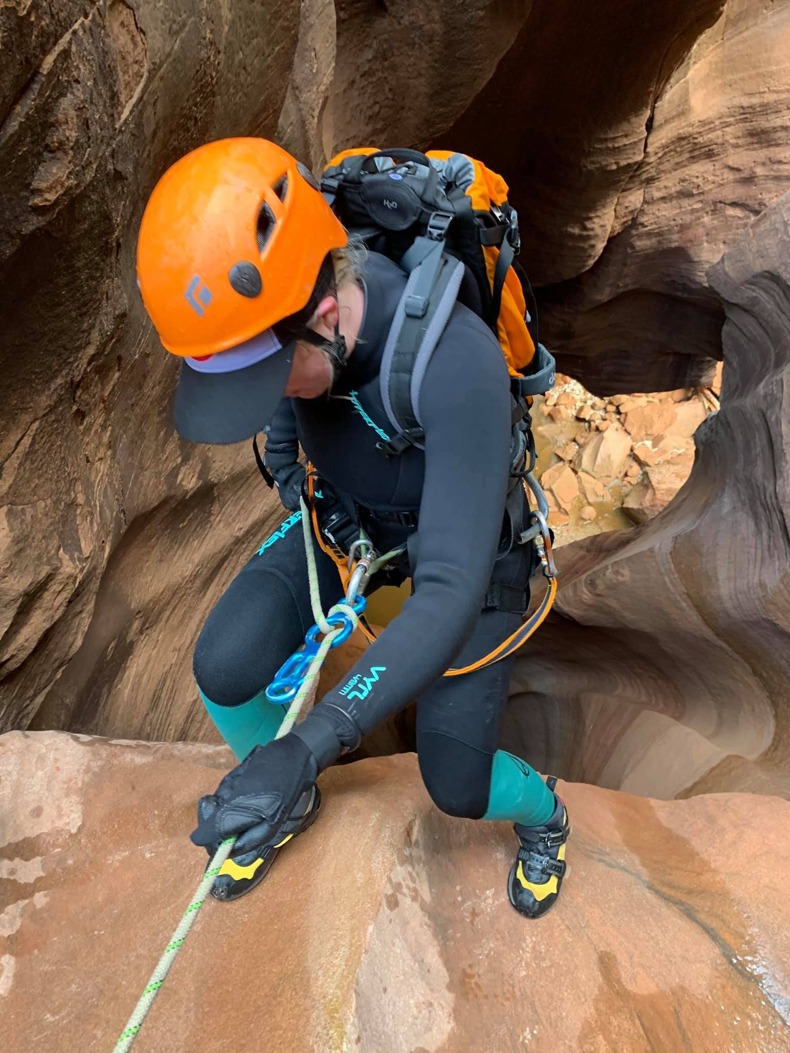
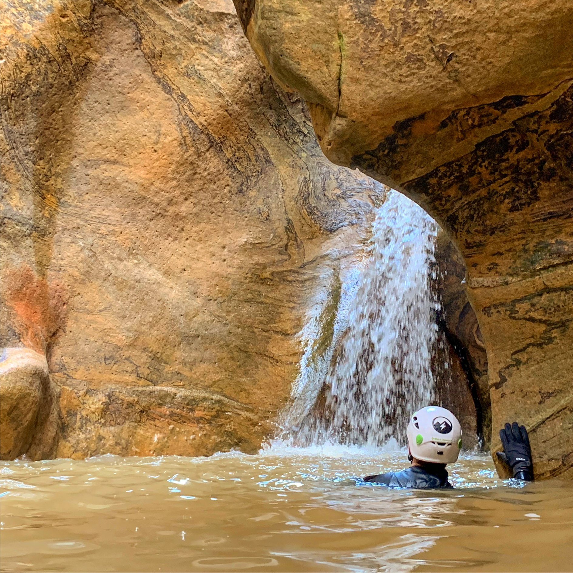
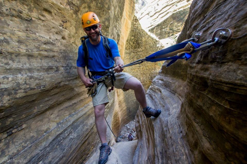
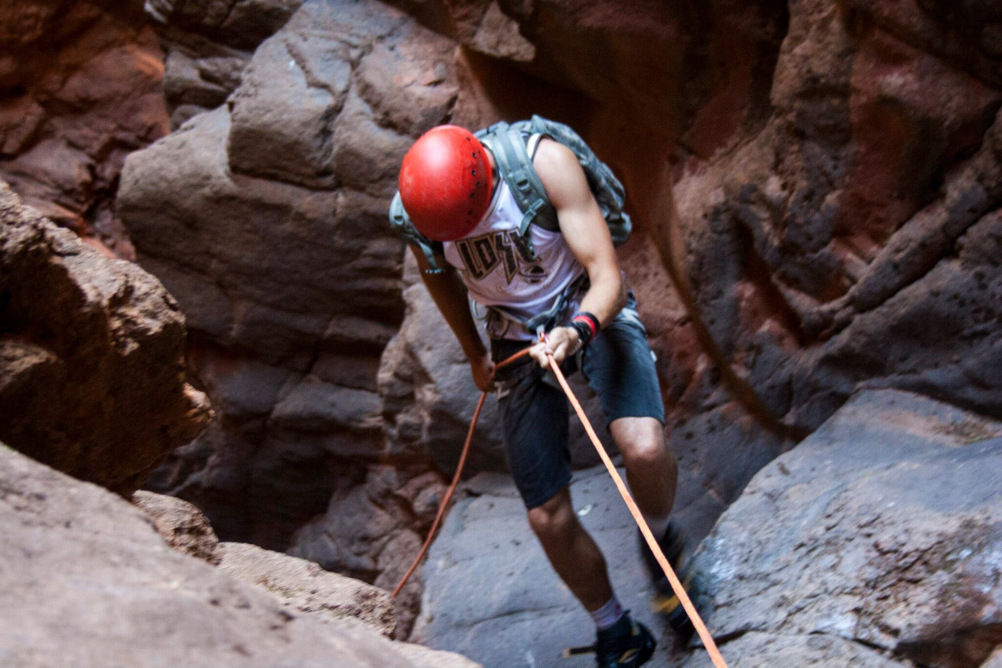
First, canyoneers look at the rope skills required, represented in a number ranging from one to four: 1 is hiking, 2 contains scrambling, 3 requires rappelling and 4 is advanced (rope skills and other technical skills are difficult). The next part of the rating is the water in the canyon. “A” means the canyon is dry, maybe some pools of water. “B” means there is swimming, but no current. “C” means there is a current and waterfalls. Then the rating system uses a Roman Numeral to show how long the canyon would take; I, is a few hours; II, is half a day; III, is most of the day; IV, is all day; V, is an overnight trip; VI, is a multiple day trip. Then is the additional risk section of the rating. An “R” means there is more risk than average in the canyon and an “X” means there is extreme risks.
The Colorado Plateau has become the “mecca” of the canyoneering world. Every different section of the Plateau offers distinctly different canyons for all variety of canyoneers. Because of the immense size of the Plateau areas within have rarely seen human contact. Native Americans lived in the areas and hunted all over the Colorado Plateau, but they were near constant water sources. Early White settlers ventured into some of the regions of the Plateau and soon found it inhospitable to crops and settlements, except the few rural communities still existent today. Remnants of these Native Americans and early Pioneers can be seen around the Plateau. The remoteness of the area is what draws outdoor enthusiasts, today.
What is the Colorado Plateau?
The Colorado Plateau is an area encompassing approximately 140,000 square miles in the four corners region of Utah, Colorado, Arizona and New Mexico (Foos). It includes the area drained by the Colorado River and it’s tributaries the Green, San Juan and Little Colorado Rivers. The dramatic scenery, what makes it an amazing recreation destination, is the product of eroding by fast moving streams leaving behind the bare rocks and deep canyons. Elevations on the plateau range from 3,000 to 14,000 feet, averaging a height of 5,200 feet above sea level.
The Colorado Plateau has been divided into six sections (Rigby, 1977): Grand Canyon, High Plateaus, Uinta Basin, Canyonlands, Navajo and Datil. There are amazing canyoneering opportunities in all these sections, but the Canyonlands and High Plateaus are the main sections in Utah.
The major structures of the plateau include broad flexures, monoclines, vertical faults, igneous laccoliths and volcanics, and salt tectonic features (Foos). The Colorado Plateau folds are different than other tight folds that usually form geologically around the world. They are broad open folds or flexures. The Kaibab Uplift forms a great arch 160 km long and 40 km wide.Wide areas of nearly flat lying sedimentary rocks are separated by abrupt bends of strata along monoclinal folds.
Monoclines, or one sided folds, form where sedimentary rocks are draped over deep-seated basement faults. Some examples of monoclines on the Colorado Plateau include the Comb Ridge, the San Rafael Reef, and the Waterpocket Fold, seen at Capitol Reef National Park.
The Plateau is intersected by long north-south trending normal faults, due to movement of crustal blocks in the Precambrian basement. These blocks are responsible for the differences in elevation across the Plateau. A normal fault forms by tensional forces and is where one crustal side wall has moved up relative to the other wall. Examples of these are; the Hurricane Cliffs, west of Zion and in the Grand Canyon, the Bright Angel Fault. These north-south trending faults and monoclines are what creates the diverse landscapes of the Colorado Plateau. The faults are more prevalent to the west and monoclines tend to occur to the east.

How did Geologic History and Layering form the perfect place for canyons?
The details may differ slightly, but all the regions of the Colorado Plateau share a similar geologic history.
Precambrian rocks are exposed in the uplifts surrounding the Colorado Plateau and in the Grand Canyon near the Colorado River. These consist of old, highly metamorphosed gneiss and schist. 1.7 billion years ago north-south compression produced continent-scale lineaments of northwest and northeast trending wrench fault zones. The Colorado River Lineament extends from northern Arizona to the Lake Superior Region of Michigan. Basement faults associated with the Precambrian lineaments were reactivated a number of times in later geologic history and are responsible for the orientation of most major structures on the Colorado Plateau (Hunt 1956).
During the Lower Paleozoic (Cambrian through Mississippian) the Colorado Plateau
was tectonically stable. Relatively thin, sheet like sedimentary rocks were deposited in shallow seas and are similar to other rocks of North America. Major unconformities which represent a global lowering of sea level have removed the Middle to Upper Ordovician and Silurian rocks. Lower Paleozoic rocks are exposed in the Grand Canyon; the most prominent being the Tapeats Sandstone of the Tonto Platform and the Redwall Limestone of the Esplanade Platform.
Deep-seated basement faults were reactivated in the Late Paleozoic to Early Mesozoic (Pennsylvanian through Triassic) resulting in uplift of Ancestral Rocky Mountains and formation of a series of northwest trending broad uplifts and sedimentary basins. The Kaibab and Uncompahgre Uplifts were elevated at this time. As they were being eroded they shed sediments into adjacent basins. One of these basins, the Paradox, had a geometry that allowed seawater to enter and be trapped in the deeper parts where it evaporated and formed salt deposits. These salt deposits play an important role in shaping the landscape at Arches National Park (King 1977).

During the Jurassic and Cretaceous, the Nevadan and Sevier orogenies on the west coast created highlands which shed considerable volumes of sediment onto the Colorado Plateau. Bentonites, weathered volcanic ash, which occur in Triassic, Jurassic and Cretaceous rocks are evidence of volcanic activity of these distant orogenic belts. The last marine deposits of the Colorado Plateau are Cretaceous in age. At this time the plateau was at sea level.
The Laramide Orogeny occurred from the end of the Cretaceous to Early Tertiary periods and was responsible for formation of the Rocky Mountains. Deformation was more gentle on the Colorado Plateau, resulting in the formation of monoclines and normal faulting. During the Eocene the Colorado Plateau was at a low elevation surrounded by mountains. These mountains were eroded and sediments were deposited in intervening basins, resulting in burial of Laramide structures. Magmas migrated upwards through deep seated basement faults during the Oligocene resulting in volcanic activity and intrusion of laccoliths, of intermediate composition. Basaltic volcanism has continued since that time up to the present.
Approximately 5 million years ago the entire Rocky Mountains and Colorado Plateau were uplifted 4,000 to 6,000 feet. This type of uplift which does not involve deformation and effects a large area is termed epeirogenic uplift. On the Colorado Plateau, uplift was facilitated by reactivation of preexisting faults and accompanied by tilting of the plateau toward the north.
Present day streams established their courses at this time and because they were lifted high above base level they began to rigorously downcut. Deep entrenchment of streams and differential erosion of the Plateau began at this time. The stream courses were established on flat lying, undeformed strata. When they eroded down to the buried Laramide structures they maintained their existing courses, eroding across the structures. This creation of deeply entrenched streams and canyons is what draws canyoneers to the Colorado Plateau area.
How Geology and Canyoneering formed perfect in Utah and the Four Corners Region
The tributaries to these deeply entrenched streams in the sedimentary rock layers of the Colorado Plateau have formed the slot canyons (narrow, high walled canyons) that are the main draw for canyoneers to come to Utah. They are beautiful and allow for a different experience to each canyoneer. Each canyon differs and offers a wide variety of challenges and problem solving. These differing canyons on the Colorado Plateau are perfect for outdoor recreation which is beneficial to everyone.
With the creation of the Colorado Plateau came an amazing landscape drawing outdoor enthusiasts from across the world. These rugged and diverse areas were made by many forces and that in turn opened up the Plateau for the use of many people.

References Cited
Atchley, R. Atchley, P. Strayer, D. (2012) Creativity in the Wild: Improving Creative Reasoning through Immersion in Natural Settings. Creative Commons Attribution License.
Black, D. (2008) Canyoneering: a guide to techniques for wet and dry canyons. FalconGuides. Guilford, CT, Helena MT. xi p.
Foos, A. Geology of the Colorado Plateau. University of Akron.
Hunt , C. B. (1956) Cenozoic Geology of the Colorado Plateau: U. S. Geol. Survey Professional Paper 279, Washington DC, 99 p.
King, P. B. (1977) The Evolution of North America: Princeton University Press, 197 p.
Ralston, A. (2004) Between a Rock and a Hard Place. (1st edition). Atria Books.
Rigby, J. K. (1977) Southern Colorado Plateau: K/H Geology Field Guide Series, Kendal Hunt Pub. Co., Dubuque IA, 148 p.